
“Heal the Grid” is a term I’ve read over the years as I try to learn more about what makes a city a city.
A grid, in reference to urban planning, means a rectilinear layout of streets. An organized north, south, east, west series of rectangles or squares that make navigation extremely easy. Think Manhattan. Many U.S. cities used this method as our cities are much younger than those in other cities, especially Europe and Africa which were developed much more slowly and over multiple cultures, times and upheaval.
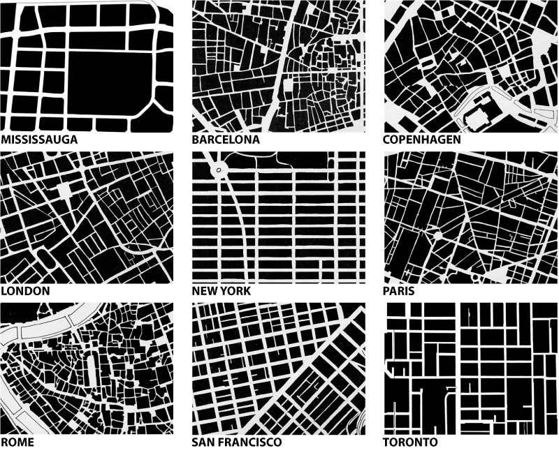
Image source - reneecrowley1 - Transatlantic Urbanism
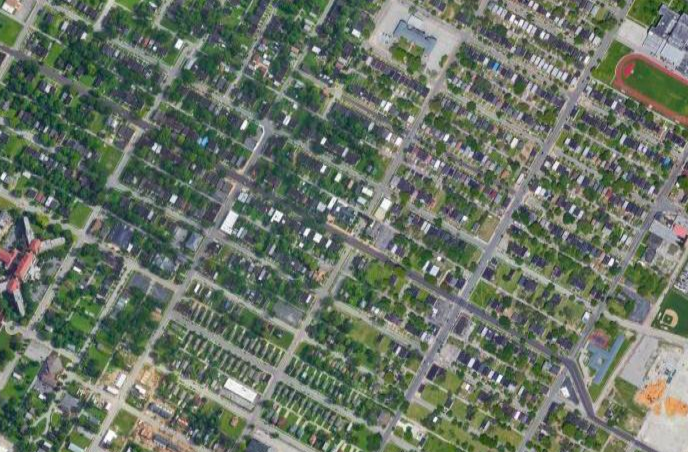
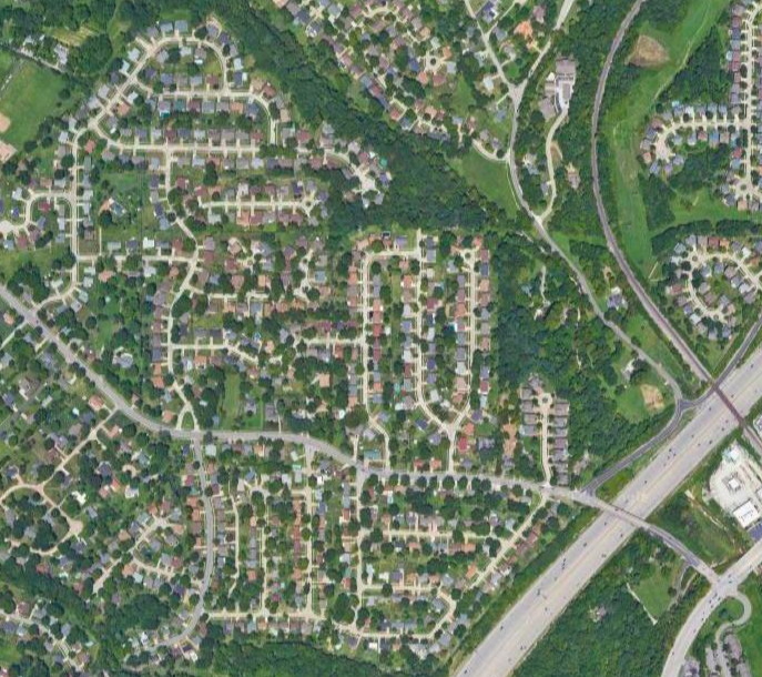
Contrast the St. Louis grid design to the favored layouts by the suburbs all over America. Look no further than the maze of one-way-in, one-way-out subdivisions and feeder roads in the area of Mehlville, MO, south of St. Louis.
St. Louis on the left, Mehlville, MO on the right (image source: Google Maps):
In urban planning, the grid plan, grid street plan, or gridiron plan is a type of city plan in which streets run at right angles to each other, forming a grid. The infrastructure cost for regular grid patterns is generally higher than for patterns with discontinuous streets.
Costs for streets depend largely on four variables: street width, street length, block width and pavement width. Two inherent characteristics of the grid plan, frequent intersections and orthogonal geometry, facilitate pedestrian movement. The geometry helps with orientation and wayfinding and its frequent intersections with the choice and directness of route to desired destinations.
In ancient Rome, the grid plan method of land measurement was called centuriation. The grid plan dates from antiquity and originated in multiple cultures; some of the earliest planned cities were built using grid plans. - Wikipedia
I believe I first heard the term “heal the grid” by reading NextSTL articles, the UrbanSTL forum and STL Tweets. In fact, “heal the grid” may be a St. Louis-coined term. Twitter hashtags show only STL derived tweets. It’s origin appears sometime around the mid-2000s when there was much talk and urban activism related to removing the sections of Interstates that cutoff the Landing, the Arch, Near North Riverfront and other parts of St. Louis from the rest of the city. An at-grade boulevard replacing I-70 Downtown was denied by Missouri Department of Transportation and City Arch River (CAR). Per a 2012 NextSTL article, they went so far as to claim “A primary purpose of the CAR 2015 project is to ease both pedestrian and bike flow from downtown into the Arch grounds. A four to six lane boulevard would restrict pedestrian and bike access, not make it better. In addition, an at-grade boulevard does not link the Arch grounds with Luther Ely Square Park and the courthouse.”
Um, yeah right…the depressed and elevated sections of I-70 really connects pedestrians to the Arch grounds. They didn’t want to do it, that simple. Of course a boulevard would be better from a pedestrian standpoint.
“Heal the grid” also came up when the Shaw Neighborhood doubled down on isolating itself from the burgeoning Botanical Heights Neighborhood by investing more in bollards and permanent closures of the long-blocked Thurman Avenue.
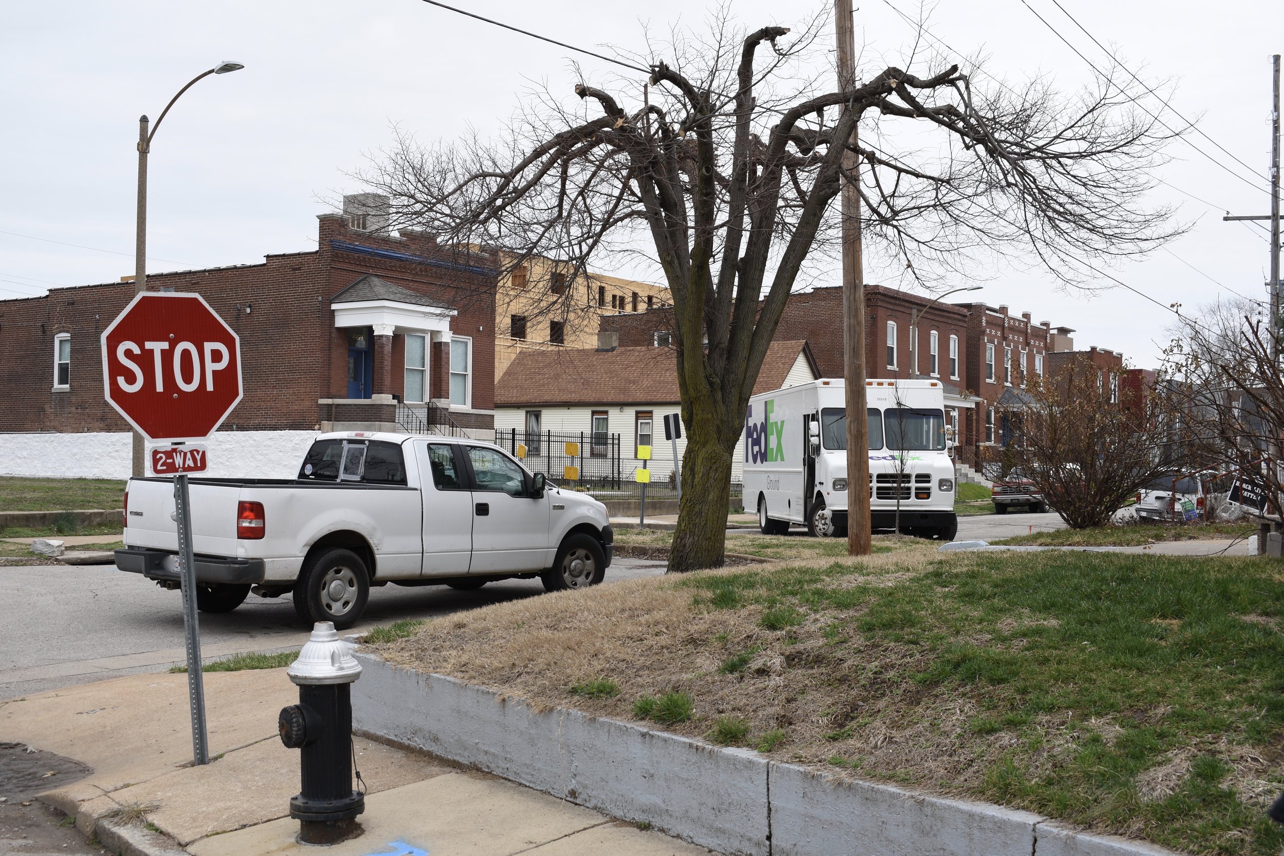
St. Louis loves isolation and trying to block out social problems like crime, abandonment and neglect by erecting physical barriers. You see it north to south, east to west in our city. Bollards, cul-de-sacs, Schoemehl pots, chain linked fences, you name it.
I reached out to Richard Bose, the interim senior editor at NextSTL and one of the primary “heal the grid” proponents to see if he wanted to meet in Forest Park Southeast (FPSE) to talk about our once perfect street grid that has been disrupted over the years for short term, selfish, insular needs.
Richard doesn’t remember exactly where “heal the grid” originated, but there is evidence it could be a St. Louis thing. Maybe it’s something the local urbanist community could hang their hats on. Maybe it’s something we could leverage to pressure the alderpersons to knock it off. As of today the politicians pass the hot potato of street closures to the neighborhood associations: the favorite place to defer hard and righteous decisions. Even the so called “progressive” alderpersons don’t entertain the idea. They know it’ll be a headache for them, so they bury their heads in the sand and do the easy thing…nothing, deferral.
I recognize this is a political conundrum. Some residents like street closures and cul-de-sacs. They tend to be the loud outspoken ones. They tend to vote on the regular. Politicians, no matter how well meaning, how progressive they are in their online branding, avoid making the right decisions in real life due to career preservation.
So maybe that means the streets department should prioritize equitable use of streets. The Mayor would have to pressure this city department not known for good urbanism and planning.
But, with a better understanding and a more selfless electorate and citizenry, maybe St. Louis could be a grassroots leader in healing the grid, reopening our public streets to do what streets are supposed to do: connect people and places. Streets are not owned by just those who live on that particular block, they are citywide entities and resources. We own them. We pay for them. Closing them for selfish, short term solutions is not good for the majority. It gives a trashy vibe, it is damaging and impossibly hard to navigate in a car. Think of the gas wasted by delivery services alone, now that we’re in the online retail era.
As St. Louis (especially north city) continues to lose massive amounts of population, we will have to think about rebuilding toward a better future. Building back a grid or healing the grid would be a great element to the plan. Among other things, a grid is connected to building wealth for its residents.
Per a 2019 CNU Journal - Public Square article by Robert Steuteville:
First, a grid results in development with a high value per acre, which is closely associated with wealth creation and fiscally sustainable land patterns, according to Joe Minicozzi of Urban3, a firm that pioneered the concept of “geoaccounting.” Bastrop conducted fiscal analysis of every parcel in the city to determine whether it was “revenue positive.” The best performing area of the city is downtown—the only place with a historic street grid.
Grids also disperse traffic—rather than concentrate it. They allow for a tremendous variety of route options, which means that individual streets can be much smaller and therefore walkable. Dendritic systems concentrate both traffic and destinations like shops and schools on large arterial roads, which must carry all of the through traffic and their size makes a car necessary for most, if not all, trips.
There are other obvious benefits to open streets and a grid. They even prevent “heart-attach traffic”, when a feeder road shuts down due to a vehicle accident or act of God and the entire area is stuck in a dead standstill because there are no other streets to use. Look no further than the vast suburbs to the west of St. Louis for what not to do. Think Lindbergh Boulevard in the suburb of Creve Coeur, MO. One accident can log jam this poorly designed stroad.
While Shaw, Botanical Heights, Skinker DeBaliviere and many other neighborhoods continue to double down on separation and isolation, other neighborhoods have the opportunity to open themselves to their neighbors.
One of the signs of a healthy city are streets functioning for all residents.
Due to the crazy amount of speeding, reckless/selfish people and street drug dealing over the years, neighborhoods have chosen to close streets to address their short term needs.
Now with cell phones, drugs are delivered to you in many cases. You see it all over. Someone runs out from their house and reaches through the car window and off they go. Technology caught up, and drive by drug dealing like we used to have pre-cell phone is becoming more rare.
If you channel two way traffic to only a few streets, and cut off the major arteries like Kingshighway and Grand, the thought was you limit drive through drug dealing.
In some cases it worked.
But at what cost?
I wanted to shed positive light and raise awareness of the rare success story of re-opening streets to connect one another vs. an intricate maze of one ways, street closures, cul-de-sacs or Schoemehl pots.
I thought the FPSE neighborhood would be the perfect place to meet up with Richard, right where Norfolk and Vista Avenue meet Taylor Avenue. These formerly closed streets are being reconnected with the street grid!
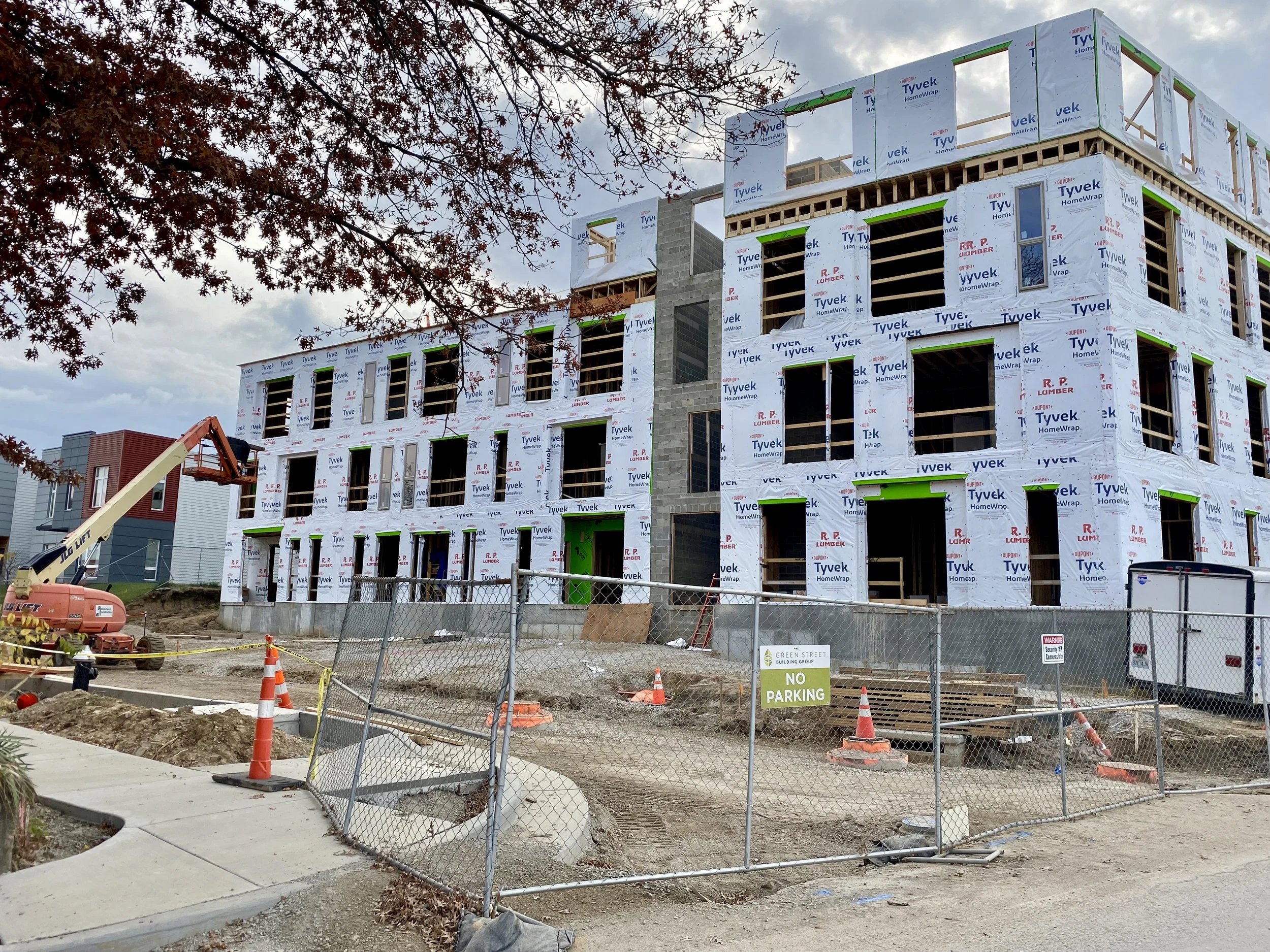
Green Street, a developer in the region, was recently located in the small suburban city of Clayton, MO west of St. Louis. Green Street is planning to move their headquarters to St. Louis.
Development firm Green Street is planning to leave its longtime Clayton home for a new headquarters near The Grove neighborhood in the city of St. Louis. Its new office will be at 4565 McRee Ave., where it is leading a $20 million redevelopment that includes dog park and entertainment facility Bar K - St. Louis Business Journal - February, 2021
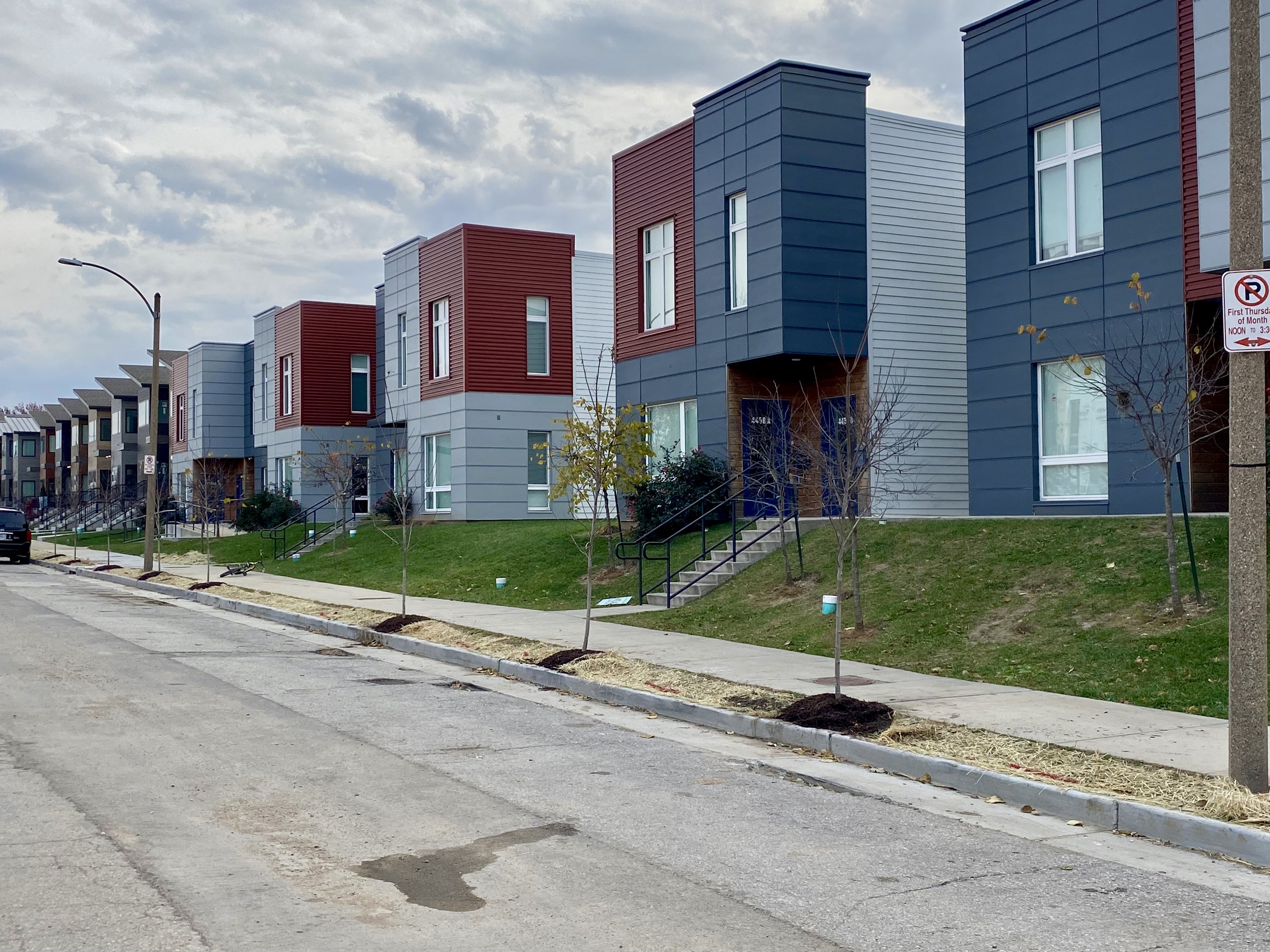
Green Street is developing some massive new mixed use buildings on the western edge of FPSE.
To improve connectivity to their new developments, they submitted an application to open some streets.
This ordinance repeals Ordinance #59043, approved on February 10, 1984, which closed Swan, Norfolk, and Vista Avenues at the east line of Taylor Avenue. The ordinance authorizes and directs the Director of Streets to reopen Norfolk and Vista Avenues, but to keep Swan Avenue closed. This ordinance will have a significantly positive effect on the City and its residents with respect to economic development and the flow of traffic in the Grove area. - Sponsor: Joseph D. Roddy
So these streets have been closed for ~37 years. The reason cited in the 1984 Board Bill closure was that the closure of Swan, Norfolk and Vista east of Taylor “will enhance and increase the stability of the neighborhood adjacent to said streets.” Further, “This ordinance being deemed necessary for the immediate preservation of the public welfare, it is hereby declared to be an emergency measure and shall become effective immediately upon passage and approval by the Mayor.”
This was deemed an emergency to public safety (read: just a few people living on adjacent streets). It proved to have little to no effect, as the neighborhood started emptying out to the tune of >30% declines in population from 1990-2010. The majority of homes along Norfolk and Vista succumbed to years of disinvestment and decay. Many were recently razed for new construction of affordable contemporary housing.
The measure to reopen Norfolk and Vista at South Taylor was unanimously approved by the Board of Alderman. The leftover cul-de-sacs will be removed and curbs will match the existing street grid. New LED street lights will be installed.
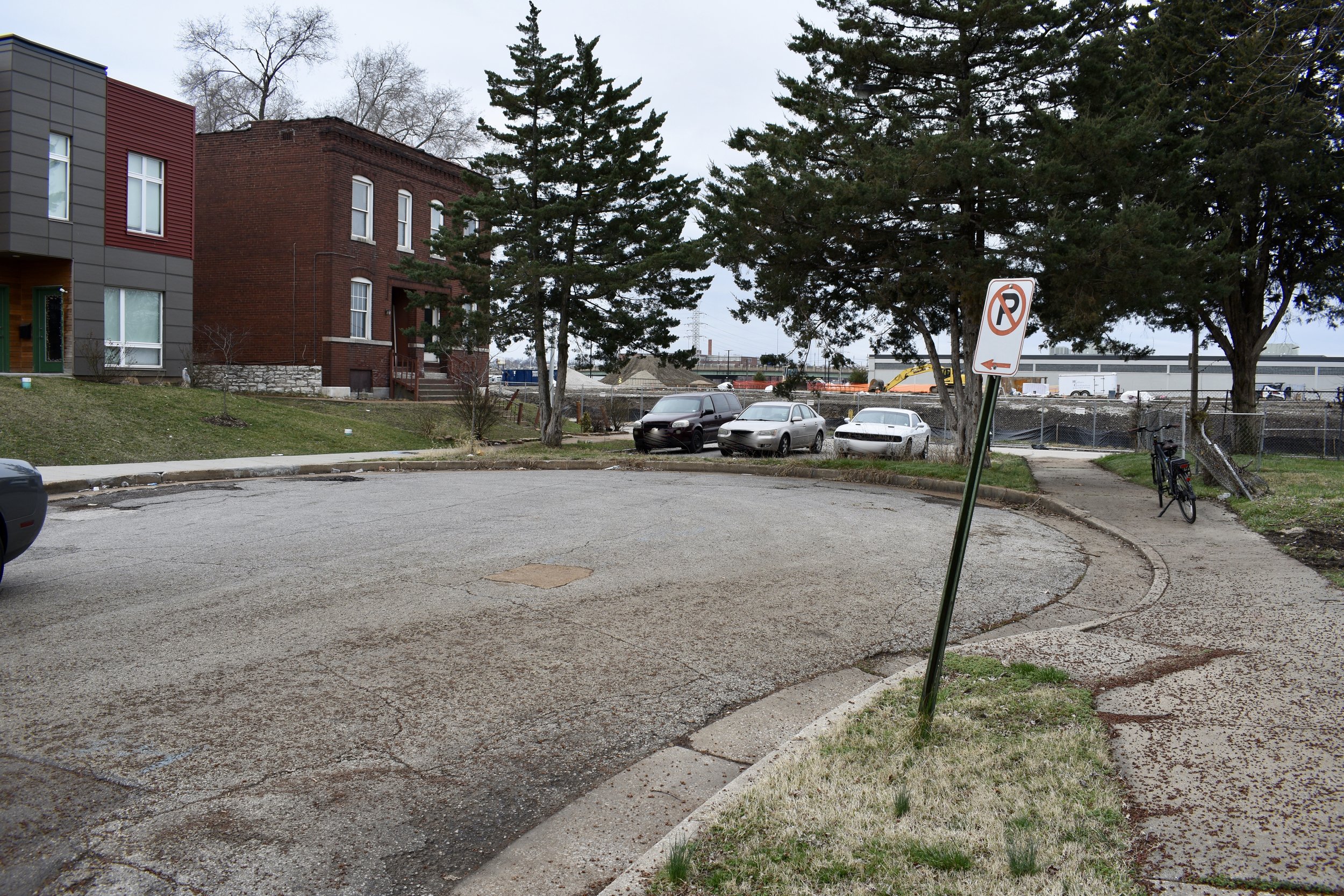
Before:

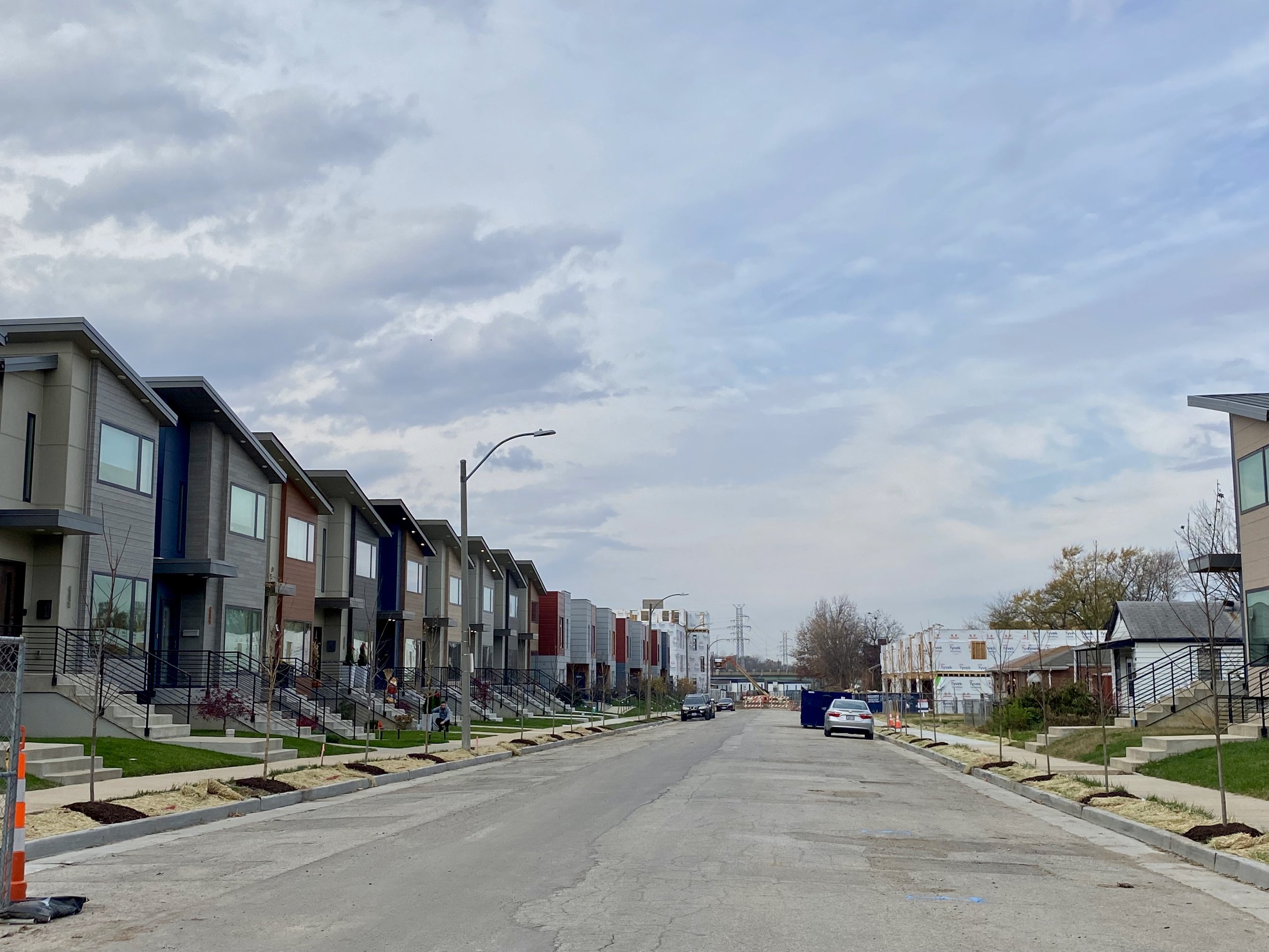
After:

Not only are the streets of Norfolk and Vista reopening, they are designed with care. There are bump outs near Taylor to discourage parking at the intersection, while narrowing the crosswalk for pedestrians and slowing down cars. There are wider easements for potential landscape and water runoff collection.

Street trees have been planted (including red maples) along both sides of each street. In ten years, this will be a gorgeous vista of tree-lined streets with incredibly varied architecture and living units.
When Richard and I visited, we hoped new sidewalks will be installed to welcome back pedestrians.

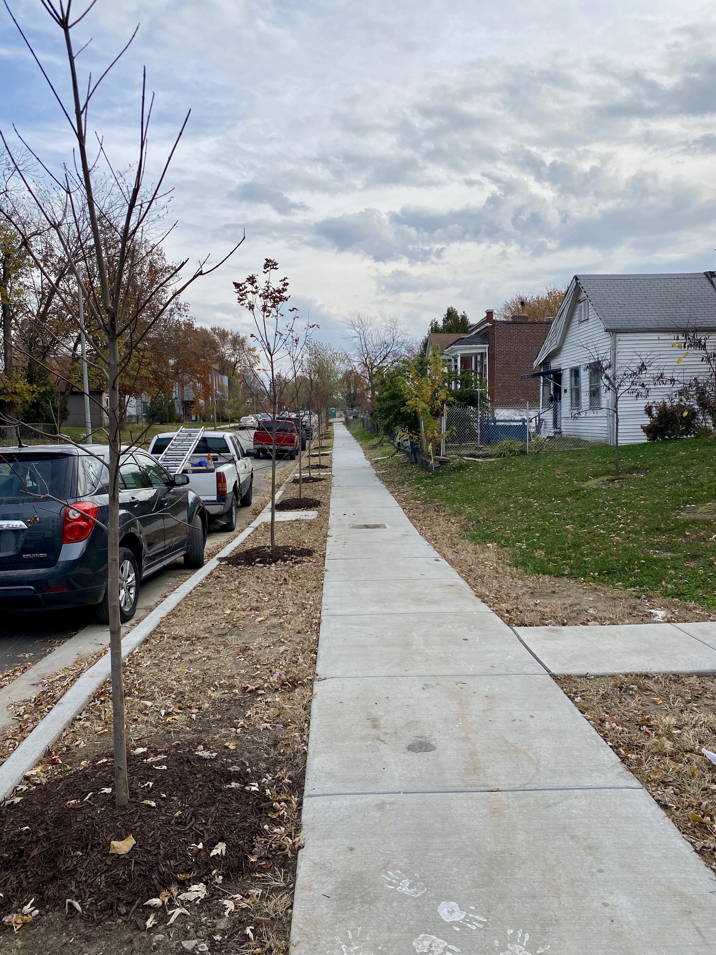
Previously impassable sidewalks along Taylor
A return visit showed evidence of new sidewalks, a major improvement for long time and new residents.


There are several other examples of streets that could be reopened along Taylor.
Greenstreet is developing a massive 300+ apartment building with 1,400 square feet of commercial space along Taylor called Terra at the Grove.


Cheers to Greenstreet for putting in the work and the city for doing the right thing by the tax payers, city-wide residents, local neighbors and new visitors to come.
And thanks to Richard for enlightening me and informing us all on urban issues.
Well done. Let’s repeat this over and over all across the city.
